This tutorial is for those who want to know a way of extracting topographic points from google earth.
Step 1: Download and install TCX Converter
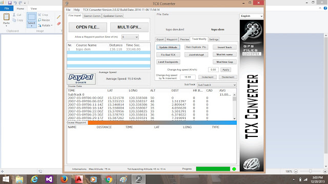
Step 6: This will now load the available points generated from the kml file. You will notice that the ALT (altitude) column lists zero (0) values. You have to update this and you need an internet connection.
Step 7: Click on the Track/Modify tab then click "Update Altitude". This should update the altitudes from the reading on google earth based on Longitude/Latitude combination. If the values on the ALT column remains zeros or error, just click on Update Altitude again. It will work. Be patient :-)
Step 8: After generating the altitudes, click on the File Export tab and click Save csv File. Click No on the dialog box that will appear to make a comma (,) delimited values. This means that the columns will be separated by commas when you view it in a text editor.
After generating this point datas, you can now use it in either GridView of Autocad Civil 3d to generate your Topographic Map.
Hope this could help...


